Who is Gerardathletics?
August 22, 2024
Discover the story behind Gerardathletics
The Unexpected Username
In the world of Geographic Information Systems and digital cartography, usernames often reflect our passion for maps, data, or coding. You might encounter handles like "Geo-something" or "map...", funnily, as you have probably seen I even have one myself – "Georard". But then there's the name I'm perhaps best known by across various platforms – "Gerardathletics".
It's a username that often raises eyebrows in professional geo circles. After all, what does athletics have to do with making maps or developing geospatial software? The answer lies in a journey that began long before I wrote my first line of code or created my first map.
Tracks to Maps: An Unlikely Journey
Before I became immersed in the world of coordinates, projections, and spatial analyses, my life revolved around a very different kind of track – the running track.
Born into an athletic family, with a father who transitioned from athlete to coach, I spent my formative years crisscrossing Spain, from one athletics meet to another. While my peers were playing video games, I was studying the arc of a triple jumper's bound or the rhythm of a hurdler's stride.
From National Champion to Digital Cartographer
As I grew, so did my involvement in athletics. What started as a family tradition became my personal passion. I found my niche in the 60 & 110-meter hurdles, an event that demands precision, rhythm, and split-second decision-making – skills that would later serve me well in the world of GIS.
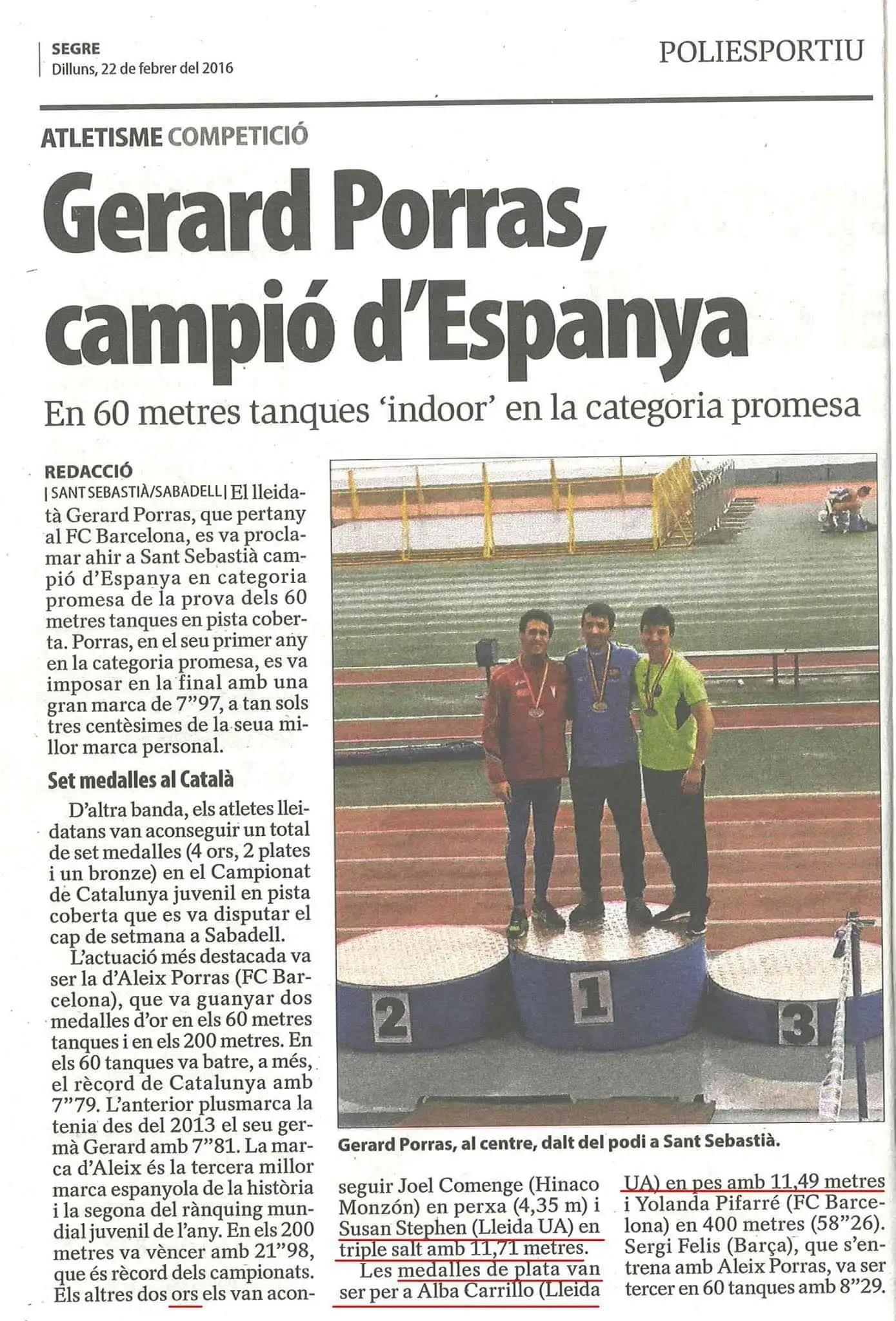
My dedication led to significant achievements in the sport. I became a national champion in all youth categories (u16, u18, u20 & u23). My success continued, culminating in a runner-up position (second place) in the 60-meter hurdles at the senior national level.
The pinnacle of my athletic career also saw me representing my country on international stages:
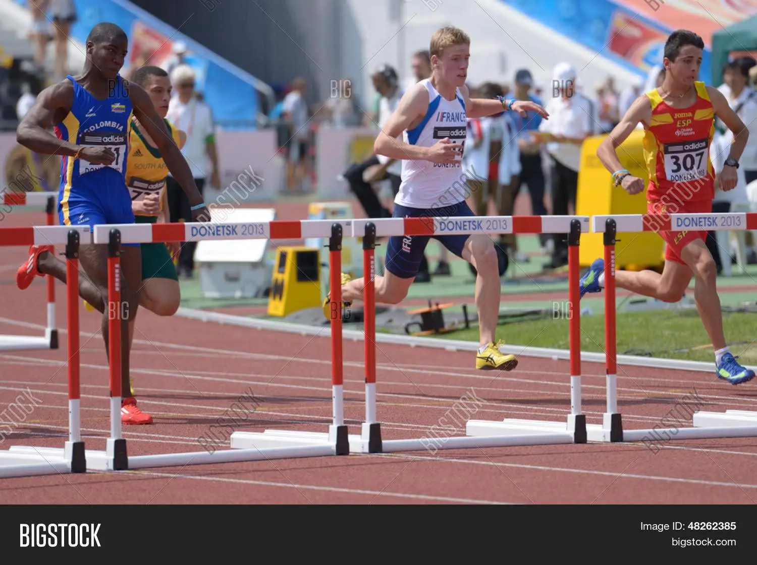
- U18 World Championships in Donetsk
- U20 World Championship in Eugene, Oregon
- U20 European Championship in Eskilstuna, where I reached the finals
- U23 European Championship in Bydgoszcz
- Senior European Championship in Amsterdam
Each of these experiences not only tested my abilities as an athlete but also shaped my approach to challenges and problem-solving – skills that would prove invaluable in my future career as a GIS developer.
The Parallels of Hurdles and Code
You might wonder how this background translates to the world of GIS. The connection is more profound than you might think. The discipline, precision, and problem-solving skills honed on the track have been invaluable in my career.
Just as a hurdler must navigate obstacles with speed and accuracy, a GIS developer must efficiently traverse complex datasets and coding challenges. The ability to break down a race into discrete sections mirrors the process of modularizing complex geospatial problems into manageable components.
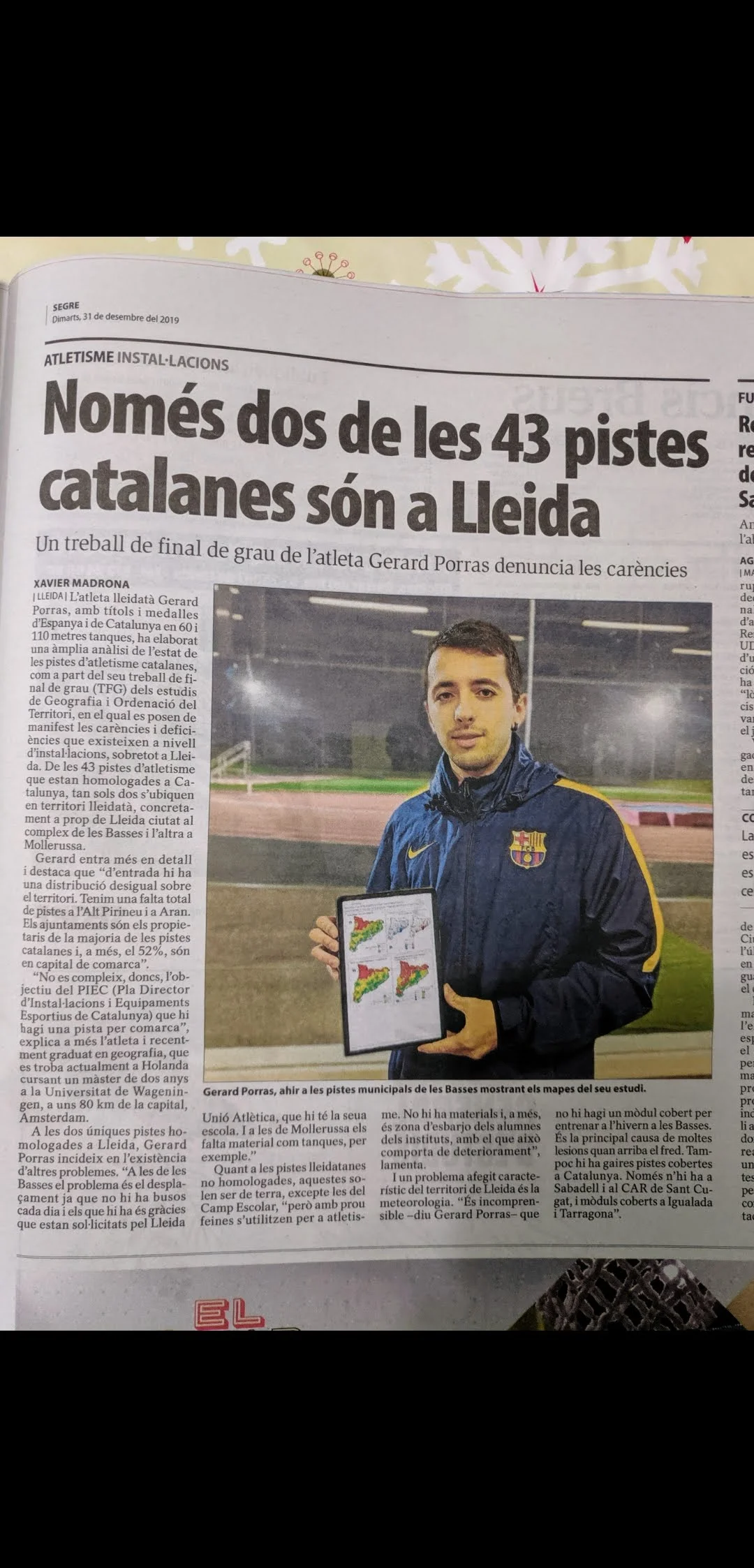
But my journey didn't stop at drawing parallels – I actively merged these two passions. I've conducted spatial analysis of athletics events, bringing my firsthand experience as an athlete to bear on geographical data. This fusion of interests culminated in my bachelor's thesis, "Geography and Sports: The Case of Athletics in Catalonia."
This academic work not only solidified my understanding of both fields but also demonstrated the unique insights that can emerge when seemingly disparate disciplines intersect.
Why "Gerardathletics" Persists
So, why keep the name "Gerardathletics"? It's a reminder – both to myself and to others – of the diverse paths that lead us to our careers in geospatial technology. It's a conversation starter that allows me to share how the principles of athletic training – consistency, attention to detail, and continual improvement – apply equally well to developing cutting-edge GIS solutions.
Moreover, it's a testament to the interdisciplinary nature of our field. GIS professionals come from all walks of life, bringing unique perspectives that enrich our work. My background in athletics gives me a unique lens through which to view spatial problems, often leading to innovative solutions.
As for me, I'll continue to map out new territories in GIS development, always with the spirit of an athlete – constantly striving, continuously improving, and forever passionate about the track I'm on, whether it's made of rubber or lines of code.
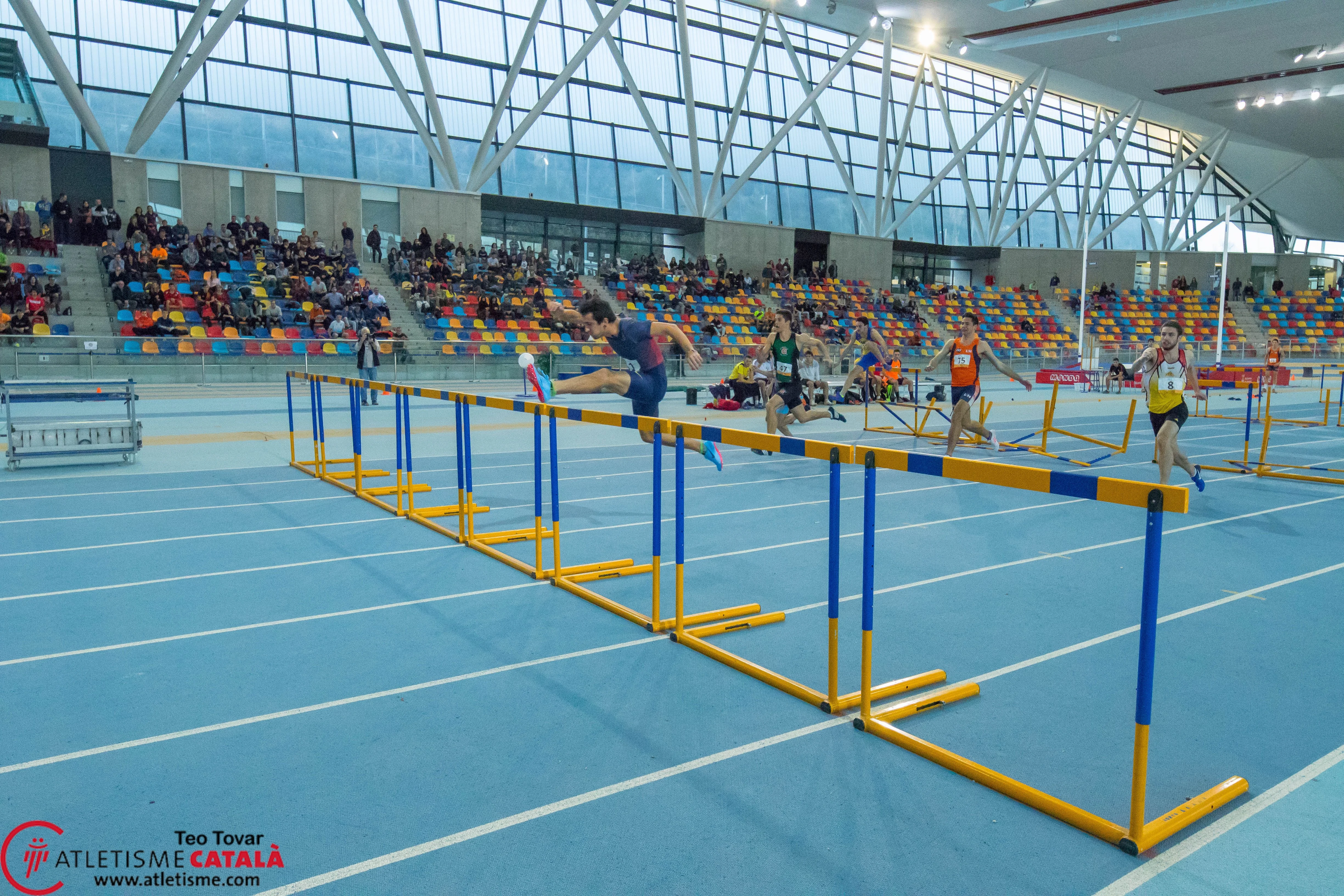
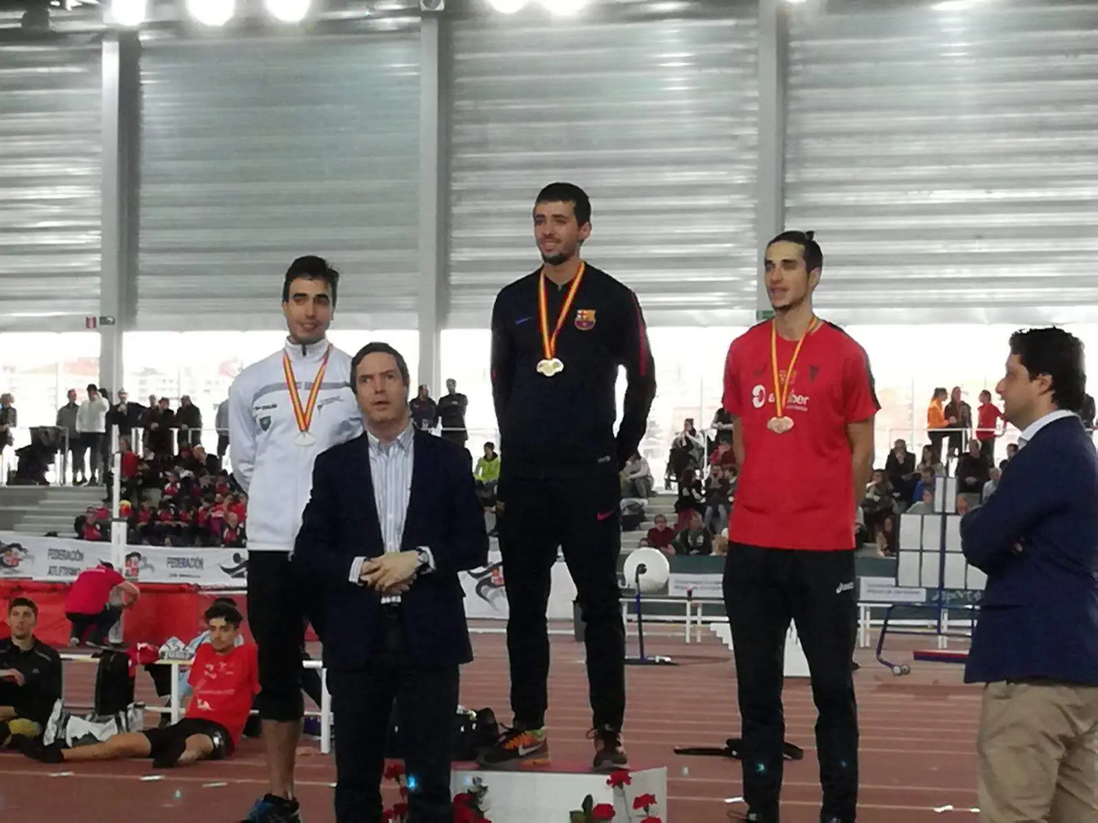
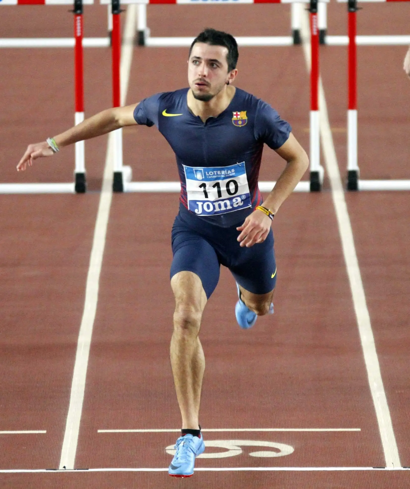
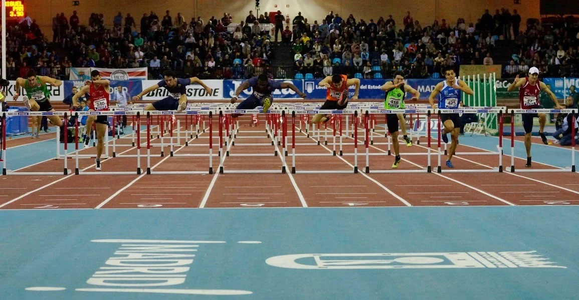
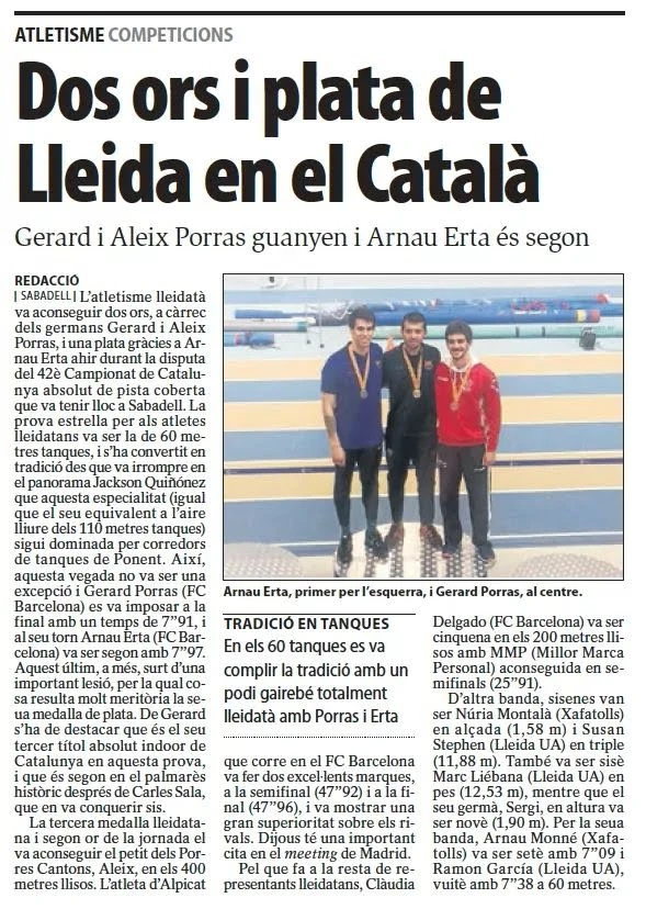
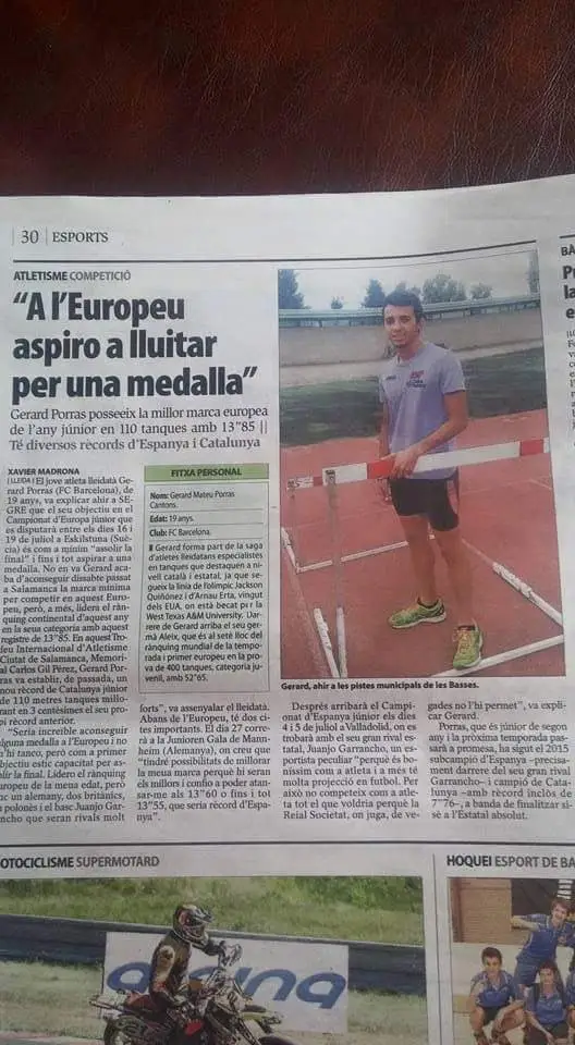
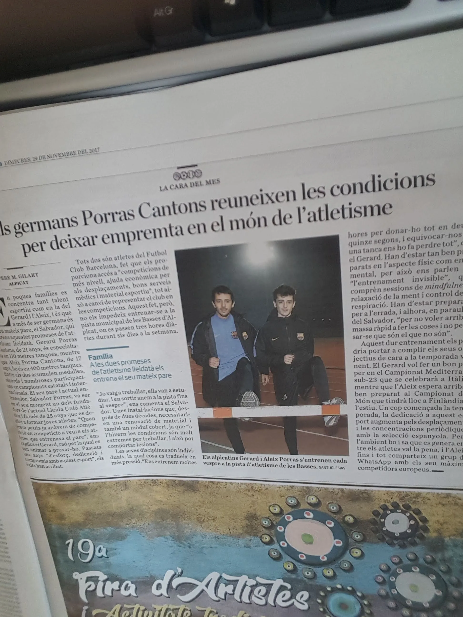
My Journey in Pictures